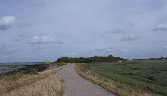
For walkers in Kent there are some notable long-distance footpaths with which to get the measure of the county (and beyond). I’ve never had the time or application to walk the entire length of the North Downs Way, the Pilgrim’s Way or the Saxon Shore Way, but over the years I’ve walked along a good part of each one, stage by disconnected stage.
The Saxon Shore Way has particular relevance for me, as my childhood was spent at one part of it (Whitstable), while I now live at another part (Rochester). The 163-mile path stretches round the Kent and Sussex coastline from Gravesend to Hastings, following not the current shoreline but the coast as was 1,500 years ago, when the Isle of Thanet was still an island, and marshland at Romney and on the north Kent coast had not been reclaimed. It was then that the Romans built a line of forts in response to Saxon raids. It is a ghost coastline, one perfectly designed for contemplating time and its changes.
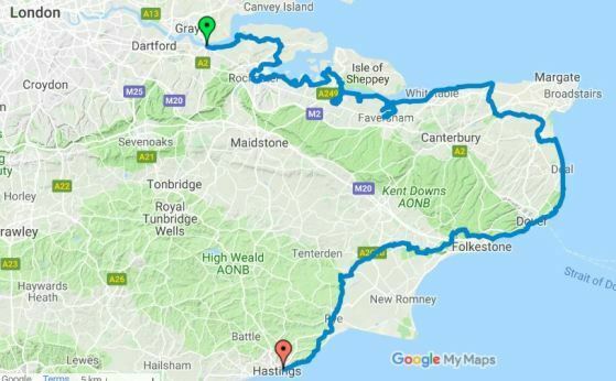
Near where I live, eastwards along the coastline to the towns of Gillingham and Rainham lies a favourite section of the Saxon Shore Way, where the River Medway meets the sea, flowing eastwards through the gap between the Hoo Peninsula and the Isle of Sheppey, beyond which its waters join the Thames Estuary and feed into the North Sea. As shorelines go, it is not conventionally beautiful, nor is it close to towns likely to attract the holidaying visitor. There is too much bleakness on view, too much mud, too little that is postcard scenic, too much of a reminder of industry. But for the local, if not the day-tripper, that is precisely where its beauty lies. And that is what leads me to Horrid Hill.
Horrid Hill – what a glorious name. It sounds like the title of a Thomas Love Peacock novel, or a location symbolic of human degradation named in Pilgrim’s Progress. It carries a shiver with it but also a mocking tone. Were you to see it on any sign or map, you’d be persuaded immediately to change direction just to find it.
It’s not much of a hill. Strip away the trees and bushes from this tiny blot of land at the end of a promontory, and it would not be much more than five metres high. How did it gets its name? There are many stories. Some say that it commemorates the sufferings of prisoners held on nearby hulks. Some say that it comes from the island’s supposed use as a location for hangings. Some say it comes from the smell of manure used on the fields nearby. A more likely answer is that the place was named in the early 1900s, when it became the location of a tiny cement works, whose cramped, unpleasant conditions gave rise to its alliterative label. Those who toiled on Horrid Hill best knew how it should be remembered.

It was an island once (if a place no more than 100 metres wide can be called an island), barely rising above the mudflats that lie between solid land and river. It was built up to support a small cement works, with a causeway being added to connect it to the mainland and support horse-drawn railway transport chalk to cement kilns on the island. Barges could come alongside (when the tide was high) and transport the cement thereafter. This continued as business until 1913. The last vessel to berth there, a barge named the Dick Turpin, ran aground nearby in 1913. Among the products it was carrying were jars of Dundee marmalade, examples of which (it is said) can still be found buried in the mud.
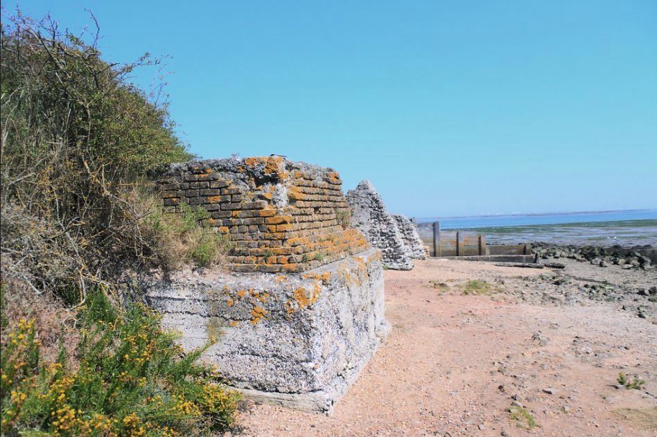
The ruins of the cement works can be found between the bushes and the shoreline, looking like the low ramparts of some latter-day castle. Now it is an offshoot of the Riverside Country Park, where locals stroll along the causeway, circle round the island, and return (the Park has a rather fine visitor centre). There are benches here and elsewhere along the abandoned coastline, many named after someone whose quieter moments were spent here, looking out into the poetic bleakness.

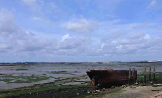
It is a beautiful place, though not all will see the beauty. It is a place of desolation. From the vantage point of Horrid Hill itself one has an epic panoramic view of all that we forget. Out there across the marshy bay lies the wreckage of lost industry, from abandoned wharves to the remains of former fishing boats, some rotted to no more than an outline in the mud, others waiting hopefully for a long-dead owner to return. On the far side of the bay, on the southern edge of the Hoo peninsula, one sees power stations, industrial estates, pumping stations, a National Grid storage centre, a wind farm, and the container terminal of the Isle of Grain. It is ugly, necessary stuff, shunted out of sight of the towns and city that it serves. To the right of Horrid Hill is another, larger projection into the river, Motney Hill. It too was once home to a cement works (a substantial business, whose output helped in the rebuilding of San Francisco after the 1906 earthquake), but now at its tip there is a sewage works, pumping out what needs to be pumped out into the waters that lead to the sea. These marshes are a waste land.
The panorama takes in Upnor in the west (whose castle saw action when Dutch ships made a raid on the Medway in June 1667, a particular humiliation for the British navy) to Grain in the east. Between these points stretches a grey, brown, green flatness, alleviated by the occasional rise in the land or meandering creek. Aside from the boat remains, the central Nor marshes (where sheep once grazed), the occasional actual sailing ship, and in the distance the long-since abandoned Hoo and Darnet forts, all is remorselessly level. It is a picture of that which is left when that which was the actual subject of a painting has been scraped away. It offers seemingly nothing but absence.
But of course we know of the fearful poetry to be found in such bleakness. Charles Dickens makes much of it in Great Expectations, whose opening scene take place in just such marshland (near, of course, to the Chatham and Rochester of Dickens’ childhood). Magwitch is an escapee from the convict hulks that were stationed in these waters. Had the name Horrid Hill been known in 1860, Dickens would have found it hard to resist using it. No screen version of the novel has quite captured the sense of these marshlands to me. Instead, look at The Long Memory, a peculiarly atmospheric 1953 crime drama directed by Robert Hamer, filmed on the North Kent marshes and around Gravesend, for a better sense of the look and the feeling.
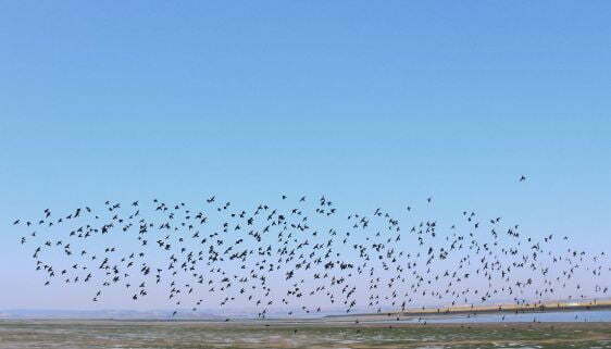
But if it is a place of desolation it is one of consolation too. It is, as said, located next to a country park. Many come here for the wildlife. Horrid Hill is a magnet for bird watchers, while the patient may be rewarded by the sight of a seal (I have never been so patient, alas). There are nature reserves nearby, and though views from the Hill might suggest silence, in reality they are accompanied by exuberant birdsong, with large flocks (starlings mostly) perched on the island’s scrubby bushes, periodically swooping out in orchestrated fashion across the mudflats to feed.
Birdsong on Horrid Hill
The country park attracts a steady stream of locals, several of whom have left their mark in named benches, indicating how much the walks and these views spoke to them. Perhaps you have to be local to understand. A discerning outsider might sense something beyond the flatness and the detritus, might see something of the forlorn beauty, but they would not have the pride. With pride comes the consolation. That which has been rejected by others has come to settle here, where it is understood and even appreciated. It is no one else’s poetry but our own.
I have been reading The Way to the Sea: The Forgotten Histories of the Thames Estuary by Caroline Crampton, a history and journey along the Thames to the overlooked coastline of the Hoo Peninsula and the Isle of Sheppey, with a final turning into the Medway estuary (though not going quite as far down as Horrid Hill). The author was raised in these abandoned territories, and though her book attempts to document the Thames in its entirety, she rushes through its familiar upper reaches to concentrate on the river beyond the Thames barrier, where the tourists stop and the forgotten takes over. She writes with eloquence and feeling of the honest beauty of the places, a honesty that comes out a refusal to deny the human part of the landscape.
There is no such thing as untouched wildness in Britain, no matter how much clever design or marketing might try and make you think otherwise. All landscapes are a result of the interaction between humans and nature. Everything around us is affected by man’s intervention or neglect, yet today’s conception of nature is one that prioritizes solitude and a sense of ‘untouched beauty’.
I’m not sure that I would want to deny people a dream of untouched beauty, and a bit of solitude among a landscape seemingly free of human intervention can be restorative (and consoling). But such dreams should not blind us to other beauties. A piece I wrote here a while back, on walking through the Hoo Peninsula, helped inspire a BBC programme in which some celebrity explored history walking through hidden corners of the country. It was reported to me that said celebrity was a little dismayed to find industrial works alongside the recommended paths, the drab alongside the green. This wasn’t the dream. But it should be.
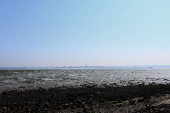
The view is consoling, and commanding. Horrid Hill, which was once only an unloved island and noisome workplace, is now the perfect vantage point for surveying the grandest of vistas and feeling that you own it. It juts us out into the waters as though we were free from the land. All about us lies our wildness, carved by humans, nature and time.
There is something in the vast stretches of emptiness that draws us. It is a different thing to deserts, plains or icy wastes. That difference may lie in the marshes and mudflats that look as though you could walk across from southern shore to northern shore, yet no person could ever make such a journey, on foot at least, or they would sink into oblivion. It is the meeting point of hope and impossibility.
So we look out, in awe of, yet understanding of the bleakness before us. Accompanied by a chorus of twittering subjects, we are the kings and queens of nowhere.
Links:
- There is a map of the Saxon Shore Way on the excellent Walking Englishman site and a handsomely-designed PDF guide to that part of the Way at Medway (including Horrid Hill) on the Medway council website
- There is a good piece on Horrid Hill and the Riverside Country Park on the naturegirl blog
A most interesting piece. My father took me on a walk to Horrid Hill and then along the river wall to Gillingham Strand on Good Friday 1953. I have visited it many times since. My secondary school form master was an enthusiastic birder who would spend hours there or in the close vicinity. He shared my, and your, views.
Thank you for your kind words. It is a place that draws you back. It is high time I visited it once again.
A lovely piece on a place close to my heart. I grew up frequently visiting this section of shoreline from the 80’s to 00’s. Have many fond memories of visiting with friends and have returned countless times for solo walks as an Adult, always drawn to the bleakness which I am utterly memorised by and have photographed numerous times. It’s actually my happy place.
And that’s a lovely comment. Thank you.
Thanks so much for this article, you have helped me figure out a ghostly encounter I had when I was around 14 years old… whilst exploring the area with friends we stumbled upon what I now know is the cement works ruin, the part that is concealed by the bushes..
As we were walking through I stopped in my tracks to see a small man sitting cross legged on the ruins, he had a long black coat and a top hat, like Victorian attire, he had such a menacing smile on his face I still to this day see it vividly in my mind, I felt so uneasy, as I turned to get the others attention, I said oh look at him’ I turned back and he had disappeared….
They didn’t believe me of course, but I swear I know I did see him… makes me shudder still
Anyone else had a ghostly encounter here?
I wonder if he was one of the convicts that were hung there.